
Posts

Is it Ash? Is it Oil? No! It’s Trichodesmium!

in /by

During recent coastal water quality and habitat surveys, we’ve come across slicks of what turned out to be blue-green alga, also known as cyanobacteria, in this case, an alga called Trichodesmium.  A biologist at the Division of Aquatic Resources confirmed that these slicks or “scuzzes” are known to periodically occur around Maui but the abundance this year appears unusual.
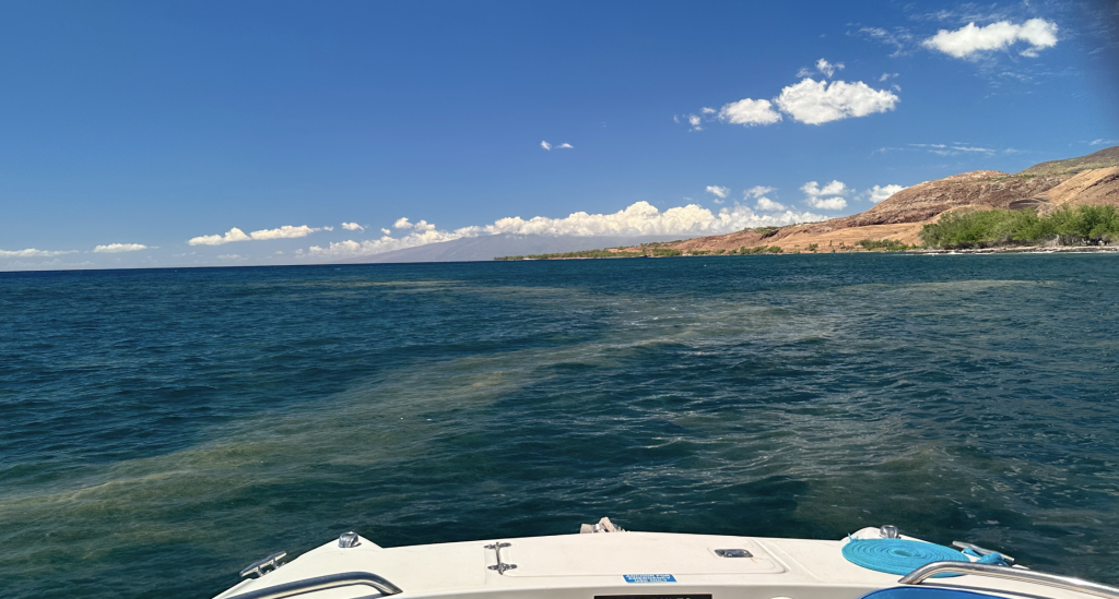
Trichodesmium scuzz by Olowalu, Maui, Hawaii. September 2023.

Trichodesmium scuzz by Olowalu, Maui, Hawaii. September 2023.

A sample collected off Kihei on September, 2023 proved to belong to the genus Trichodesmium. Trichodesmium, also called “sea sawdust” due to its appearance, plays a pivotal role in marine ecosystems. These microscopic organisms are widely distributed throughout tropical and subtropical oceans, forming distinct colonies that can be visible to the naked eye. Trichodesmium is actually ecologically important, as it is a primary producer in the marine food web and also contributes to nutrient cycling and nitrogen fixation, benefiting marine life and the planet as a whole.

A little bit of ecology

Trichodesmium is crucial to the health of marine ecosystems. These cyanobacteria are photosynthetic, using sunlight to convert carbon dioxide and nitrogen gas into organic matter – a process known as nitrogen fixation. This ability to fix atmospheric nitrogen makes Trichodesmium a critical source of bioavailable nitrogen in nutrient-poor ocean regions, such as Hawai’i and much of the tropical Pacific. As a result, it provides essential nutrients to a variety of marine organisms, including phytoplankton, zooplankton, and filter-feeding invertebrates. By supporting the base of the marine food chain, Trichodesmium indirectly sustains the health of larger marine species, all the way up to fish and marine mammals.
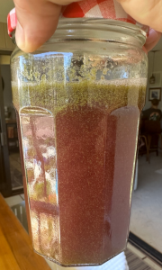
Trichodesmium from a 2023 scuzz in Kaanapali, Maui, Hawaii. Photo: Trey Garnes.

Trichodesmium from a 2023 scuzz in Kaanapali, Maui, Hawaii. Photo: Trey Garnes.

Blooms and Causes

Trichodesmium blooms are periodic and can cover vast stretches of ocean surface. These blooms occur due to a combination of factors, including warm water temperatures, nutrient availability, and calm sea conditions. The warm waters of tropical and subtropical regions create ideal conditions for Trichodesmium growth, while the presence of nutrients like iron and phosphorus can stimulate bloom formation. There is some speculation that ash from the recent Maui wildfires may have dropped enough nutrients into our coastal waters to trigger the blooms we are now seeing close to shore.

Calm seas and low wind speeds can further allow Trichodesmium colonies to remain at the ocean’s surface, forming visible mats that can stretch for kilometers, which is what we are currently seeing around Maui. These blooms can have both positive and negative effects on marine ecosystems, promoting productivity but also potentially leading to oxygen depletion and harmful algal blooms under certain conditions.

Health Concerns

While Trichodesmium is an essential component of marine ecosystems, it is not suitable for human consumption. Ingesting or touching Trichodesmium colonies can cause skin irritation and, in some cases, lead to respiratory problems due to the release of certain toxins and irritants. It is advised to avoid direct contact with these cyanobacteria. Moreover, the ecological consequences of large-scale Trichodesmium blooms, such as oxygen depletion and changes in water chemistry, can have negative effects on marine life and local fisheries.
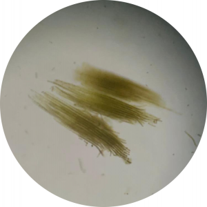
Trichodesmium

Trichodesmium

Fun fact

There are several species of Trichodesmium. Some make little urchin-like balls made up of individual strands others look more like bundles of rods on close inspection.  All species have spaces (vacuoles) that hold gas and as a Trichodesmium rolls around underwater, the flash of light off these bubbles can give the water a sparkly appearance.

Report your sightings!
If you see a Trichodesmium scuzz washing up on the beach or while you are out on the water, please share your observation.  Date, time and location are important details. A photograph or video of the bloom would be appreciated.

Please share your sightings with us by email at [email protected].
 

Special Event: Mapping Leeward Coral Reefs Before the Impacts of Storm Runoff from the August 2023 Wildfires

in , /by

After the devastating wildfires in Lahaina and Upcountry Maui, the community has been trying to recover from the effects of this unimaginable event. Even as our community is on the mend, a second, disaster slowly approaching the island. The areas burned by the wildfires have been stripped of cover and soils and toxins are poised to wash downstream into our coastal waters and into groundwater. What the effect on our coral reefs, long-term water quality, and resources, such as food fish, will be is uncertain.

Maui Nui Marine Resource Council invites you to an important FREE Zoom webinar on Thursday, Sept. 14 at 6:00 p.m. to find out more about the effort to rapidly map the current, baseline conditions of coral reefs along leeward Maui where the impacts of fire-related runoff are expected to occur. Register here: https://bit.ly/LI_coral_maps

Brett KettleYou’ll meet Dr Brett Kettle of Flying Fish Technologies, who has pioneered coral reef protection for over three decades, both on the Great Barrier Reef (GBR) and internationally. Brett began to prototype his long-term vision for a high-speed, broad-scale underwater visual survey tool in 2017. His vision was to document more of the Great Barrier Reef than had ever been documented before and to use emerging technologies like AI/ML to accelerate the analysis of collected data. The result is the Vertigo3 glider, a towed ROV that can survey 10ha (25 acres) an hour while recording over 50,000 high-resolution images.
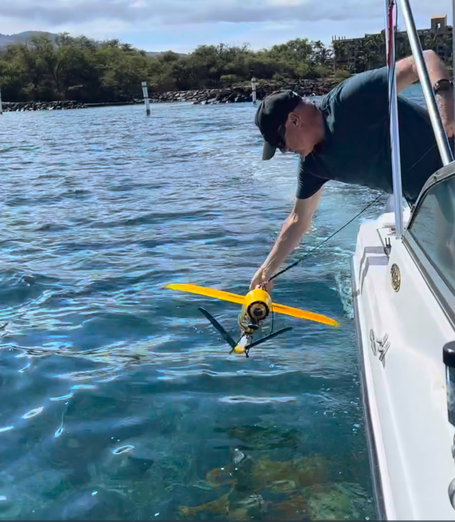
During the webinar, you’ll be introduced to how Vertigo3 functions and how it is being used to image extensive sections of Maui’s leeward reefs. These images will allow comparison of the current state of coral reefs that may already have been impacted with unaffected “control” regions and will allow accurate assessment of any effects when storms deliver runoff to our precious nearshore reefs. The technology also opens up a remarkable set of opportunities to view and study Maui’s reefs from above the water in ways that were impossible until now.

Save your seat for the Webinar: https://bit.ly/LI_coral_maps

Brett deploys the Vertigo3 Glider off of the Kihei Boat Ramp in Maui, Hawaii

Brett deploys the Vertigo3 Glider off of the Kihei Boat Ramp in Maui, Hawaii. Photo: John Starmer, MNMRC.

Maui Now: Ocean water testing begins off Lahaina

in /by

Preliminary water testing in the nearshore waters off Lahaina is showing that physical parameters, like temperature, PH, salinity, and dissolved oxygen, are currently in normal ranges.

Russell Sparks, an aquatic biologist with the DLNR Division of Aquatic Resources, said, “We have ongoing concerns that pollutants from the fire will make their way into the ocean at some of the drainage outfalls or from storm drains. For years we’ve done regular monitoring, but now we’re including testing from the fire zone. We’ll be sending samples off to… (Read More).

Maui Times: Lāhainā Prepares for Potentially Toxic Stormwater Runoff Amidst Hurricane Season

in /by

Maui residents have been manifesting rain, but this actually may be harmful to the waters surrounding Lāhainā. On Aug. 8, a wildfire damaged or destroyed most of the town, including more than 2,200 structures — 86% of which were residential. In the midst of hurricane season, there is concern over potentially toxic sediment runoff, which naturally occurs after heavy rains.

“You really have this toxic soup,” said John Starmer, chief scientist at the Maui Nui Marine… (Read More)

Civil Beat: Race Underway To Glue Down The Lahaina Fire’s Toxic Ash Before Rains Wash It Into The Ocean

in /by

With showers forecast over parts of Hawaii early next week, officials and environmentalists are scrambling to protect nearshore waters off Lahaina from becoming polluted with fire-related runoff.

The remnants of post-Tropical Storm Fernanda are expected to bring moist air and possible showers to windward and mountainous portions of Hawaii, including Maui, according to (read more)

Free Presentation on “Wildfire on Maui: the History, Threat, and Our Collective Responsibility”

in /by

Did you know that the area burned each year by wildfire in Hawaii has increased by 400% over the past several decades? Wildfires have an impact on our nearshore ocean environment and coral reefs, which is why Maui Nui Marine Resource Council is hosting a free presentation on “Wildfire on Maui: the History, Threat, and Our Collective Responsibility” on Wednesday, February 6.

The presentation will be offered by Clay Trauernicht, PhD, Wildland Fire Specialist at University of Hawaiʻi Cooperative Extension. It will take place from 5:30 pm to 7:00 pm at Pacific Whale Foundation’s classrooms at the Ma’alaea Harbor Shops at 300 Ma’alaea Road, Ma’alaea (Wailuku). Doors open at 5:00 pm and complimentary refreshments will be served.

“Over the past decade, an average of more than 1,000 wildfires burned more than 17,000 acres each year in Hawai‘i, with the percentage of total land area burned comparable to and often exceeding figures for the fire-prone western United States,” reported Dr. Trauernicht.
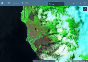
“During my presentation, we’ll use fire science and a bit of history to tackle the how and why of the 400% increase in areas burned by wildfires in Hawaii,” said Dr. Trauernicht. “We’ll also look at the consequences it has for our watersheds and nearshore ecosystems.”

“The short story is that fire on Maui and other islands is a problem we’ve largely created,” he noted.  “It is therefore one of the few ‘natural’ disasters we can actually avoid.”

“We’ll consider our options to reduce fire risk and impacts on Maui and how the urgency to take action is increasing under a changing climate,” Dr. Trauernicht reported.

Attendees will be invited to share their questions, experiences and ideas about wildland fires on Maui at the conclusion of Dr. Trauernicht’s presentation.

Dr. Trauernicht earned his PhD in Plant Science at the University of Tasmania and a MS in Botanical Sciences at the University of Hawaii at Manoa. He completed his BS in Biology at the University of Denver.  In addition to many years of botanical and ecological fieldwork, he has published and presented on plant community ecology and population modeling, geospatial analyses of fire and species occurrence, and the use of local knowledge to adapt management strategies and inform research needs.
His current focus is on improving wildland fire management in Hawaii and the Pacific with a strong emphasis on science extension and communication.  Dr. Trauernicht is the project leader for the Pacific Fire Exchange, part of the Joint Fire Science Program’s nationwide Fire Science Exchange Network.  He is currently working with the Pacific Island Climate Change Cooperative to extend climate science resources to Cooperative Extension programs throughout the Pacific Island region.

Maui Nui Marine Resource Council is a Maui-based nonprofit organization celebrating 17 years of working for healthy coral reefs, clean ocean water and an abundance of native fish for the islands of Maui County. In addition to co-managing the Hui O Ka Wai Ola ocean water quality testing program, which tests ocean water quality at 39 locations along the south and west shores of Maui, the nonprofit is working to improve ocean water quality in Ma’alaea Harbor through the use of installed oysters in cages. Maui Nui Marine Resource Council is also working in the Pohakea watershed above Ma’alaea Bay to prevent fire and erosion to protect ocean water quality and the coral reefs located in the bay. To learn more, visit www.mauireefs.org.