Since September 2023, Maui Nui Marine Resource Council (MNMRC) has been working to help scientists understand how toxic runoff from the wildfire impacted Lahaina’s coral reefs.
Through the support of grants, and other generous donations, MNMRC used cutting-edge drone and AI technology to measure the health of Lahaina’s reefs before the impacts of the fire took place. Understanding how healthy reefs were before toxic runoff entered the ocean is critical to helping scientists identify how it has changed and what problems the fire could have caused for Lahaina’s nearshore ecosystem.
3D maps: A record of reefs before the fire
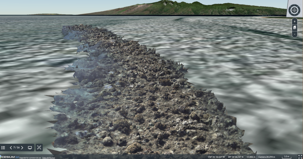
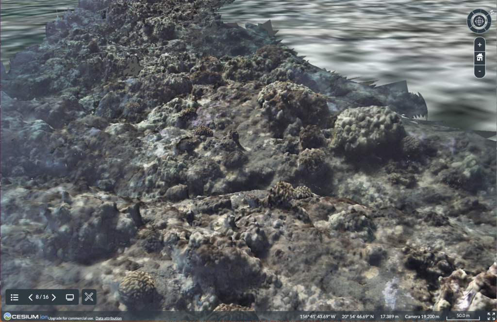
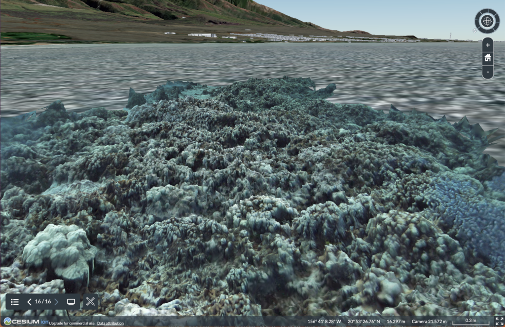
3D map of reefs in Lahaina before toxic debris, runoff, and other waste from the fire was washed into the ocean. (Photo Credit: Flying Fish Technologies)
In September 2023, MNMRC’s partner, Flying Fish Technologies (FFT) used their underwater drone, the Vertigo3 glider, to capture over 800,000 images of the reef before heavy rains washed debris, toxins, and other waste from the fire into the ocean.
These images were used to create 3D maps of the reefs, which serve as a snapshot of the area “before” any fire impacts could occur. By comparing these maps to images collected after the toxic runoff was carried into nearby waters, MNMRC can better understand how the reef has changed due to the fire and by extension, figure out how to protect it from further damage.
Using AI to understand reef health
In addition to creating 3D maps of priority sites, FFT trained and applied a machine-learning algorithm to the extensive image database to count and identify coral and fish species at several sites in Lahaina. This information is another helpful way to understand reef health because when a diverse mix of corals and fish are found in enough numbers, it almost always means the reef is healthy. When the number of species and diversity is low, the opposite is expected. This is another metric scientist can use to understand what is going on in a particular area and can also help to determine if we need to take action to help the reef recover.
The road ahead: revisiting Lahaina’s reefs
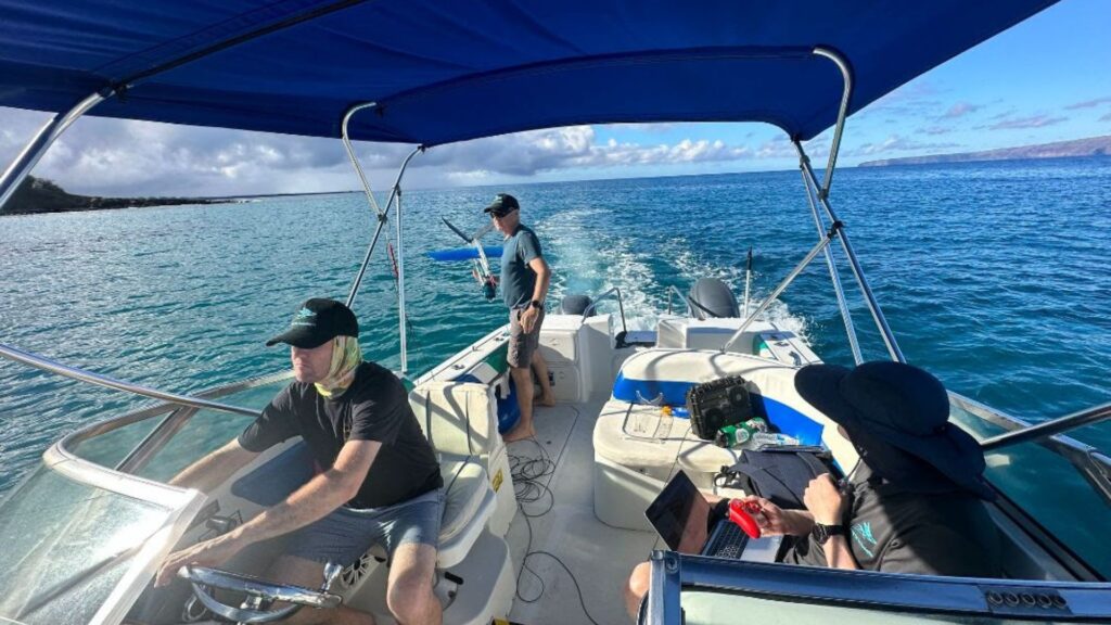
Staff from Flying Fish Technologies travel along West Maui to deploy their Vertigo3 underwater drone in September 2023. (Photo Credit: Flying Fish Technologies)
Now that heavy rains have washed runoff from the fire into the ocean, our next step is to revisit the sites shown in the 3D maps and AI videos to capture an “after” snapshot of the reef. It is critical to revisit these sites as soon as possible to record any changes in the reef before the data is lost.
We are in the process of fundraising to bring the FFT team back to resurvey the areas affected by storm runoff in 2025. Flying Fish Technologies are again generously donating their time and equipment for this fieldwork and we are seeking to raise the funds to provide the logistical support for the survey operation.
Once we revisit the sites, we will finally have a “before” and “after” snapshot of the reef and can compare them to identify the problems that have developed due to the wildfire. As always we will share our findings with the community and work together to care for and protect Lahaina’s precious coral reefs.